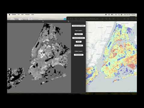
An application to predict urban heat island temperature fluctuations based on vegetation, population density, hydrology, and more, using a Tensorflow CNN, using data from the US Census Bureau, NASA Earth Observatory, and satellite GIS to curate accurate training data for the city of New York.
EcoMap has the potential to revolutionize urban planning and environmental education by providing a hands-on tool for exploring the impacts of different environmental factors on urban temperatures. It can serve as a valuable resource for city planners, environmentalists, educators, and citizens, promoting informed decision-making and fostering a deeper understanding of sustainable urban development.
To run the application Tkinter and Python is required on your system. All other packages are on the virtual environment. Simply run application.py
Placed 6th at the 2024 AI For Change Hackathon.